
The goal of this trip was to get to the southern part of Virgin Mesa rim quickly and and check out a road that I saw in the aerial photo that was not there in my earlier explorations. I am splitting this into two parts because there are so many photos.

This part will cover the 6 mile hike along the rim. The total trip mileage was 28 miles.

Back on the rim, I did this next part on foot.

Looking across San Diego Canyon, Redondo Peak is in the center. The mesa across the canyon is Cat Mesa.
 It looks like there was a crack in the cliff that opened up and then filled in.

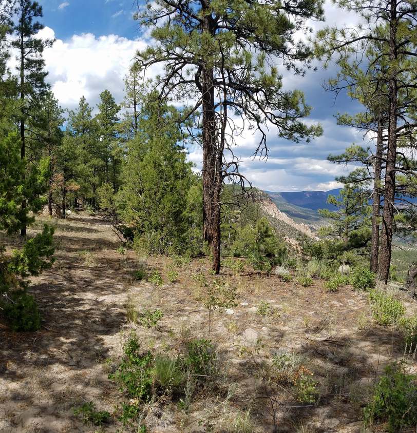 This is the route along the rim.
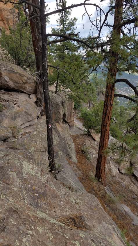
 I wasn't following my GPS closely and got onto this ledge between the cliffs.
The route is on a ledge below this one.
 That lead to finding this little cave and a rare find of petroglyphs in the next photo.

To me, it looks like a face with a large head dress above a bird or dinosaur? I can't make anything out of the rectangle, can you?
 Backing up a bit, I could see it was a chief riding a horse.

I was glad I went the wrong way. This was awesome!


The ledge pinched out. I had to back track and go below it. The reason I never found this before is because I had always been going the other direction.

You've got to love the views.

Looking back south - This is where the route goes.

Looking north - I was trying to see if there was a way to get through the other end of the ledge in the photo above.

Looking south
 Scroll for an 180 degree view

The route does a switchback in the previous shot to avoid having to climb out this steep section.

Enough talk. Enjoy the views.


You are being watched.

There are many of these carved sculptures. They are always cool to see.

Remember where these are if you need shelter from a rain storm.

This is the route.


More nichos - You can curl up and take a nap here to wait out a rain storm.


The route drops down here. This is a challenge to get the bike up that if you are riding alone.
There is another place further south where I have been able to get the bike up when alone.

Banana Yucca - If you get stuck on this ledge, at least you'll have some food. When ripe, these taste like bananas. Yuccas can be used to make cordage.


The route is on the sloped rock you see below the little oak brush.
This is not a route for the timid.

This is where you drop down or climb up to get between the ledges.
If you miss this spot, you won't get through.
You have to shoulder the bike.

Above the drop - This is where you drop down. Don't miss it.


A monsoon shower. I was glad I wasn't over there.

This is a switchback climbing back up to the rim.

A bad place to have a tree fall - The route is just to the right of the rock ledge, under the log.

The rim route goes straight ahead. Going north it stays west of the rim to get around a stretch that is impassible on the rim. There is another route that goes
left that let's you go south bypassing the section on the ledges below the rim. I went that way back to the bike and then back to camp on the west side of the
mesa from there. I must have been focused on getting back and didn't take any photos the rest of the way.
This was an awesome adventure. It impressed upon me why I love doing these trips so much. The diversity of this area is beyond description.
The route following the Virgin Mesa east rim is no 'walk in the park', but for the serious adventurer it is one that can't be forgotten.
For now, the rim can be followed for seven miles. Eventually I hope to define the last 4 miles to the south and another 3 miles on the north end.
back to Photo Gallery - Jemez Mountains