

-->
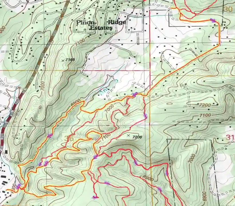
This adventure starts at the Gutierrez/Milne Trailhead just south of the Cedar Crest Post Office. To make it easier to follow this route more maps are below.

The following maps show the sequence to follow for each of the loops.
From the trailhead, drop into the canyon. Take the center trail up the arroyo. The other end is label Chaparral on the Open Space map. I'm not sure if it is called that.
This section takes you to the Eagle Ridge Trail terminating at Gutierrez Canyon Road.

Go back on Eagle Ridge Trail to Canyon Trail

This will go down the Emergency Access Road, tie back to CanyonTrail and climb out Doe Run Trail to Pinon TrailRoad, then to the San Antonito Open Space.


Take Pinon Trail Road back to Milne Open Space. Take the west side of Arroyo Loop south to the trail you started on. This time go up Sandia Vista to Doe Run, to Sierra Vista Bypass and come down Wagon Road.
Location: Sandia Mtn-East
Trailhead: Gutierrez/Milne
Distance: 20.6 mi.
Climb: 2650 ft.
My Time: 5:40 hr.
Moving Time: hr.
Aerial view from the south,southwest.

Aerial view of the San Antonito Open Space from the south.
Download tracklog for this adventure in .gpx format.
Download tracklog for this adventure in .kml format.
Return to Adventure Index