La Madera - Pipeline Area |
Where is it? On the east side of the Sandias, North of La Madera and east of Placitas Why haven't you heard about it? This is one of those special places that I've been riding since the 1970s. I've taken a few friends out there, but really didn't want this area to be well known. So why are you letting the cat out of the bag? Because this area is currently under consideration in the Cibola National Forest Travel Management Plan for designation as an area open to full size off road motorized vehicles. What is the National Forest Travel Management Plan? A mandandate has been handed down that will determine Off Highway Vehicle (OHV) usage on National Forest lands. Once the project is finalized, motorized vehicle travel will be restricted to designated roads or trails shown on a map published by the Forest Service. There will be five classes:
The proponents see this as area as an ideal area for 4-wheeling and rock crawling. It offers challenging terrain and they believe 'nobody else is using it' so they should be able to. They feel that they would have a minimal impact on the environment. The narrow canyons in the area are of prime interest to them. Opponents like the area for its solitude, for hiking and for horseback riding, believe that it is an important wildlife corridor and should be protected, move way out there to get away from people noise and vehicles. Should this area be designated as a playground for OHVs or should it be protected? Let's explore the area. Here is an excerpt of the map on the Forest Service web site. You can see the entire map on the following link. http://www.fs.fed.us/r3/cibola/travel-management/20070502_prelim_prop_system_north.pdf |
Placitas is just off the top
left corner of the map. La Madera is a little south of the lower
right corner. 
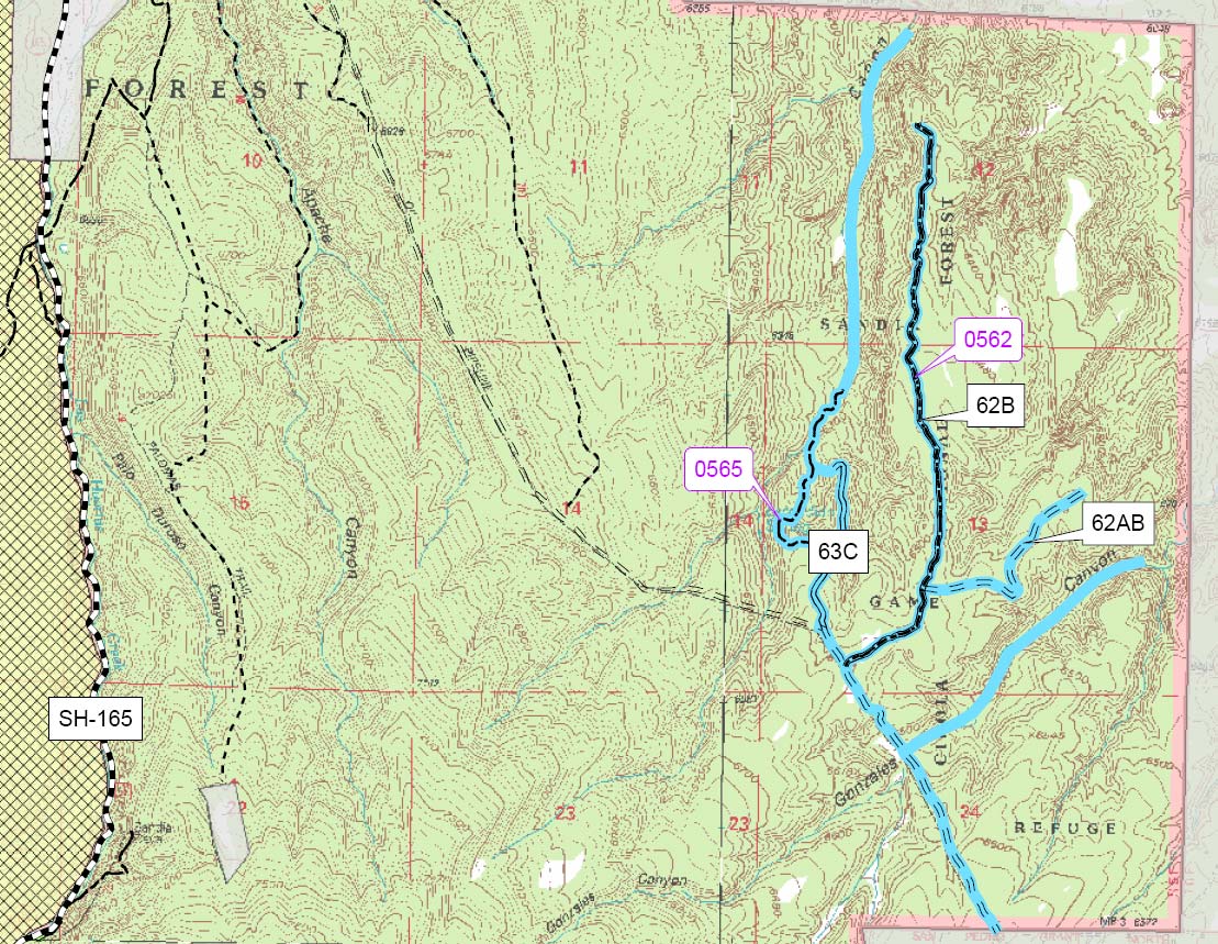
The roads shown in blue are the ones being considered for designation. A few more were added at the last meeting. Three of these are not really roads, but follow the canyon bottoms. |
|
![]() |
|
If you have ridden out here at
all, you 've probably been here. This is where the road in rejoins the
pipeline. |
|
![]() |
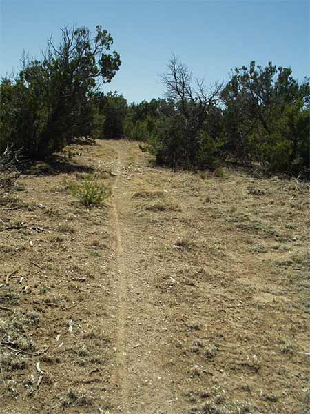
This is one of several horse trails on the south end of the area. The local residents try to alternate the use of them so that they don't get worn and eroded. These are not something that you would drive all the way out here to use on a regular basis, but for those who live out here they are very valuable. It's more about the solitude and peacefulness than going for an action packed ride. |
![]() |
|
Another horse trail |
|
![]() |
|
There are some nice views from
the edges of the mesas. |
|
![]() |
|
The real treasure is down in the
canyons. This is in Gonzales Canyon 
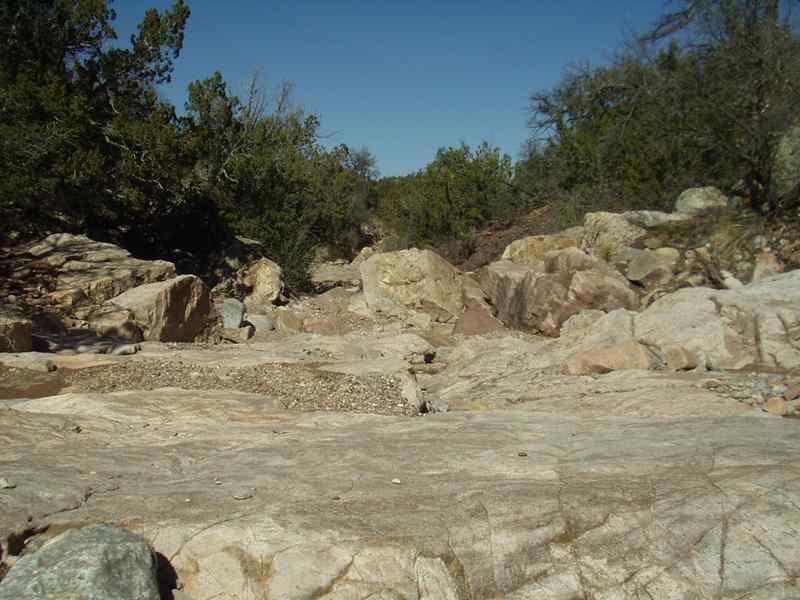
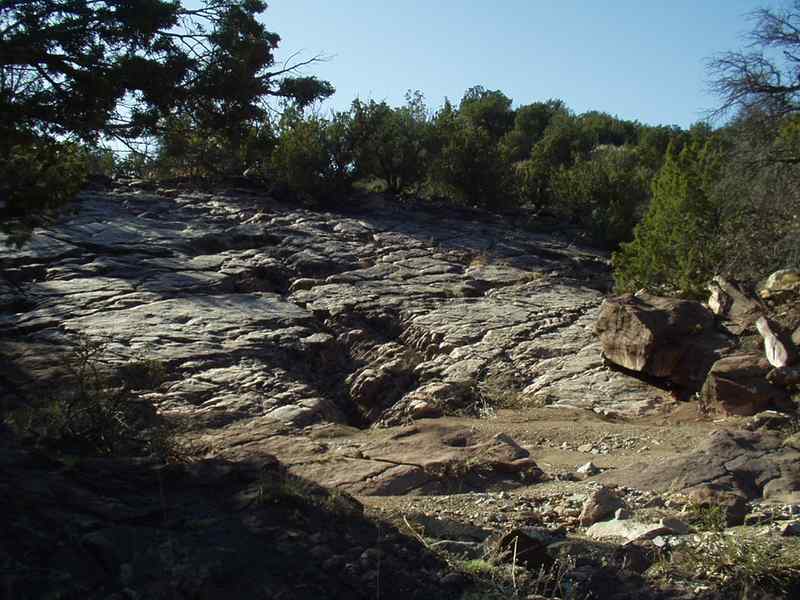
The scenery is great and if you like technical riding this canyon is a blast. It's also great for hiking or horseback riding. The rock crawlers like climbing over the boulders. |
![]() |
|
Parts of the canyon are wide and
pretty easy. |
![]() |
|
Other sections are more
challenging. These are the kind of challenges the rock crawlers are
looking for. |
![]() |
|
More challenges |
![]() |
This is a side canyon off of Gonzales Canyon. The rock crawlers are built to climb over rocks and boulders, so if a tree gets in the way, they can just drive over it and mash it down. |
![]() |
|
More challenges up the side
canyon |
![]() |
|
Opps. a tree got in the
way. What was that about minimal impact? |
![]() |
|
The proponents for making this
area open for OHV use want a route up this canyon to make a loop that
would connect back up to the top of the mesa. Trees where cut here. It is illegal to build roads on the National Forest without a permit. |
![]() |
|
![]() |
|
A little further up the canyon |
![]() |
|
The vehicle didn't make it much
further after this point because the canyon becomes to rugged. If
this area is open to motorized travel, will the users abide by the rules? Or will they try to explore into other canyons? This area is remote. How will the rules be enforced? |
![]() |
|
Will they keep trying to push on
through until they make it? What would this look like after that? |
![]() |
|
Box work on the wall of the
canyon |
![]() |
Back in the main canyon. A vehicle got stuck here. It is impressive to see what they've driven over. I'm sure it's a lot of fun, but is that the way these canyons should be enjoyed? If skilled users get stuck, what happens when those who don't have the skills or proper equipment? The vehicle that got stuck here was probably well armored. If others try this without skid plates, the chances of a puncture in an oil pan, gas tank or radiator very real. |
![]() ![]() |
|
Will springs and wells
downstream be contaminated? The ranch owners to the north and east of this area are very environmentally conscious and are concerned about the consequences of vehicle operating in this area. The animals living in this area and those who pass through are dependent upon this water. |
|
![]() |
|
Heading up Gonzales Canyon |
![]() |
|
It is impressive what these
vehicles can go over. Will vehicle that don't have the clearance try to
go around the spots. |
![]() |
|
You can still see tracks here,
even though it rained a couple days before I did this ride. Some people
find it very disconcerting to see tracks in an area like this. If this area is designated for OHV use, these canyons will become roads. |
![]() |
|
The proponents claim that the
canyon is boxed in and that would keep users from leaving the
designated route. It would be no problem for vehicles to leave the canyon here. |
![]() |
There is a drop of several feet in the center of this photo. The vehicles had no problem going through here. |
![]() |
|
![]() |
|
A view to the northeast
climbing out of the canyon |
![]() This is a bootlegged road that the vehicle pushed through just a few years ago to let them get into Tejon Canyon. It is very steep and not sustainable. |
|
![]() |
|
Past erosion Another
place where the vehicles could easily leave the main route |
![]() |
|
This area has a lot of variety and makes a great ride or hike. |
![]() |
|
![]() |
|
![]() |
|
![]() |
|
Some bedrock that is fun
to ride on. |
![]() |
|
Would this look the same with
regular vehicle traffic? |
![]() |
|
ATV tracks over the rocks and
brush the canyon past where the "road" drops in |
![]() |
|
ATVs went through here. |
![]() |
|
and here. The impact
though disturbing, may not be significant when it is has only been done
once or twice. What would it look like this if it got regular use? |
![]() |
|
Bushes in the way? No problem?
So a few parts fall off. It helps mark the trail. |
![]() |
|
Stuff in the way ? Just
run over it. It will get chewed up eventually. An ATV went all the way
up Tejon Canyon to the pipeline. There where no vehicles in these canyons untill just a few years ago. These canyons where pristine. |
![]() |
|
This is road 62B on top of the
mesa. Much of it looks like this. It's niice but not the most exciting
place one could ride or 4-wheel for that matter. Should this area be open to vehicles for the ~ 2miles of road like this. |
![]() |
|
This is part of road 62AB. It
hasn't been used for some time. |
![]() |
|
This area is used for hiking and
horseback riding and those users enjoy the solitude that it provides. |
![]() |
|
![]() |
|
![]() |
|
You can have an influence
on this area. Let the forest service know how you feel about it. Should it be opened to motorized travel or protected for future generation to enjoy as it is. You will still be able to ride, hike or ride horses in the area either way. Email your comments to CibolaTravel@fs.fed.us |
Home | Return to Photo Gallery |
7528 |